Spoiler alert: Today was a really good day!
It didn’t seem to start that way when the Aviemore Youth Hostel fire alarm went off at 3am and we all had to stand out in the parking lot for half an hour. Eventually we were all allowed back in and I reset my ambitious 6am alarm for 6:30am. At 6:30am nobody else in my dorm was stirring so I did my best to strip my bunk, gather all my stuff, and creep out in one go. I don’t know of anything missing yet so it may have worked.
I ate a still-cautious breakfast and got on the road around 7:30am. Sunny! Yay! Some lovely bike paths out of town through open birch woodland and occasional heathland.
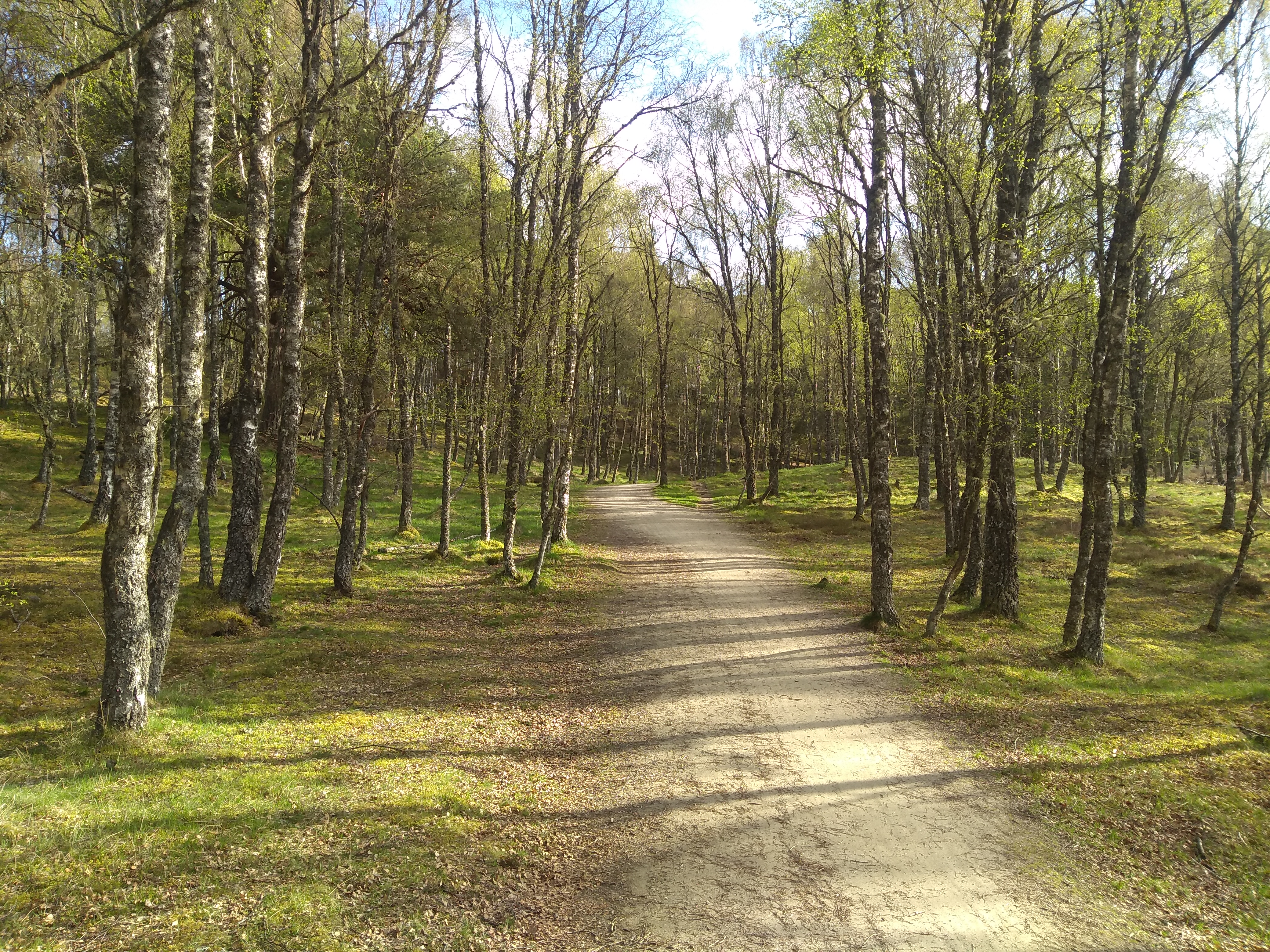
Bike path leaving Aviemore
After about 11 miles the route went through Carrbridge and past a rather elegant bridge ruin. That ain’t no car-bridge I hear you say, and you’d be correct. It was apparently a pack horse bridge.
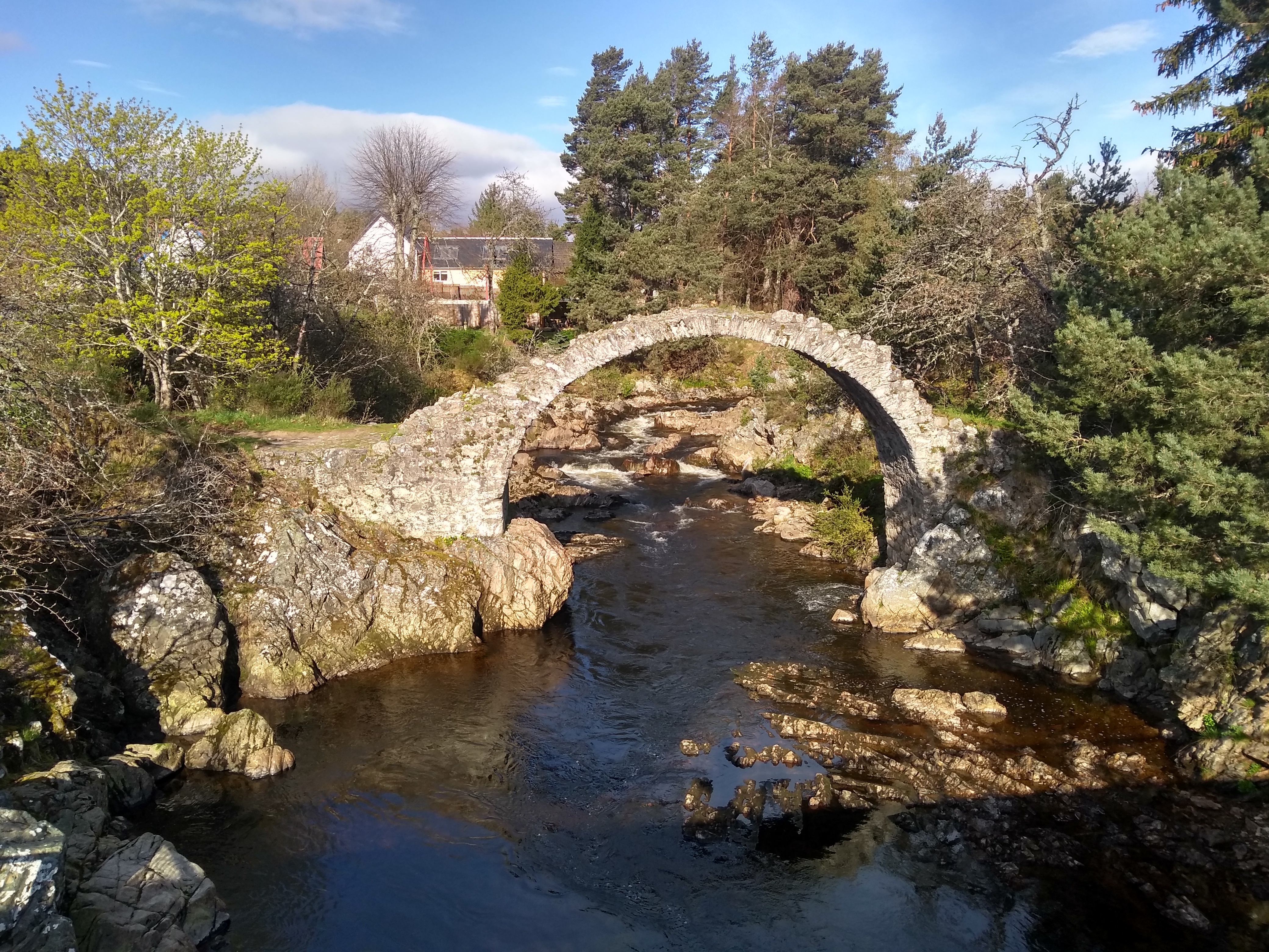
Old pack horse bridge in Carrbridge
Soon after that I’d completed the gentle series of climbs up from Aviemore, and the path toward Inverness has an abundance of lovely downhills.
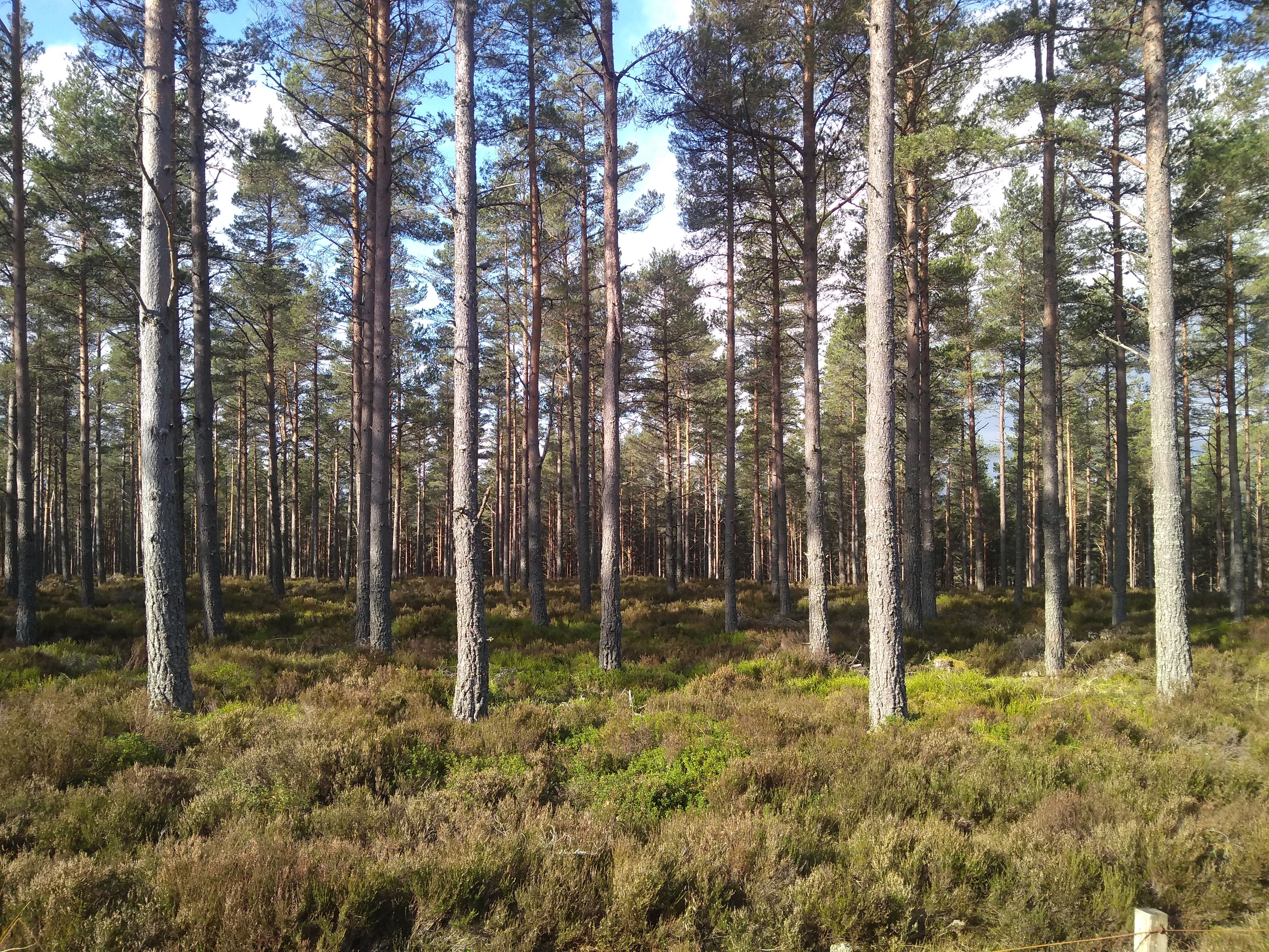
Scots Pines in Scotland
Into Inverness past various Battle of Culloden sites including some that Kata and I visited a few years back. At 40 miles in I’d planned to stop for coffee and cake in Inverness but was somehow uninspired. I refueled with snacks I had and pressed on over the Beauly Firth bridge. Confusingly, it seems that Inverness is where the River Ness flows into the Beauly Firth and then all that becomes the Moray Firth. Maybe there is a River Moray in the mix somewhere.
Over the next block of land to the Cromarty Firth, Cromarty being one of those places that many Brits know the name of but not where it is, because it is a location on the traditional radio shipping forecast. Anyhow, that was 54 miles, half way, and so I stopped for lunch in Dingwall at Batty’s Baps. Still gloriously sunny.
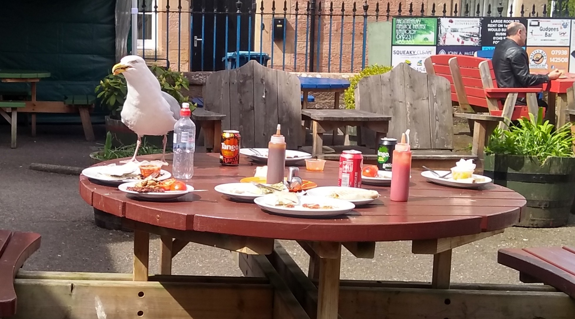
A seagull quickly swooped in to scavenge when a party left
Along the firth-side and then up over some hills again afforded good views out to the Dornoch Firth. For a while I even removed my bright yellow “arms” and was just wearing the short sleeved bike jersey on top.
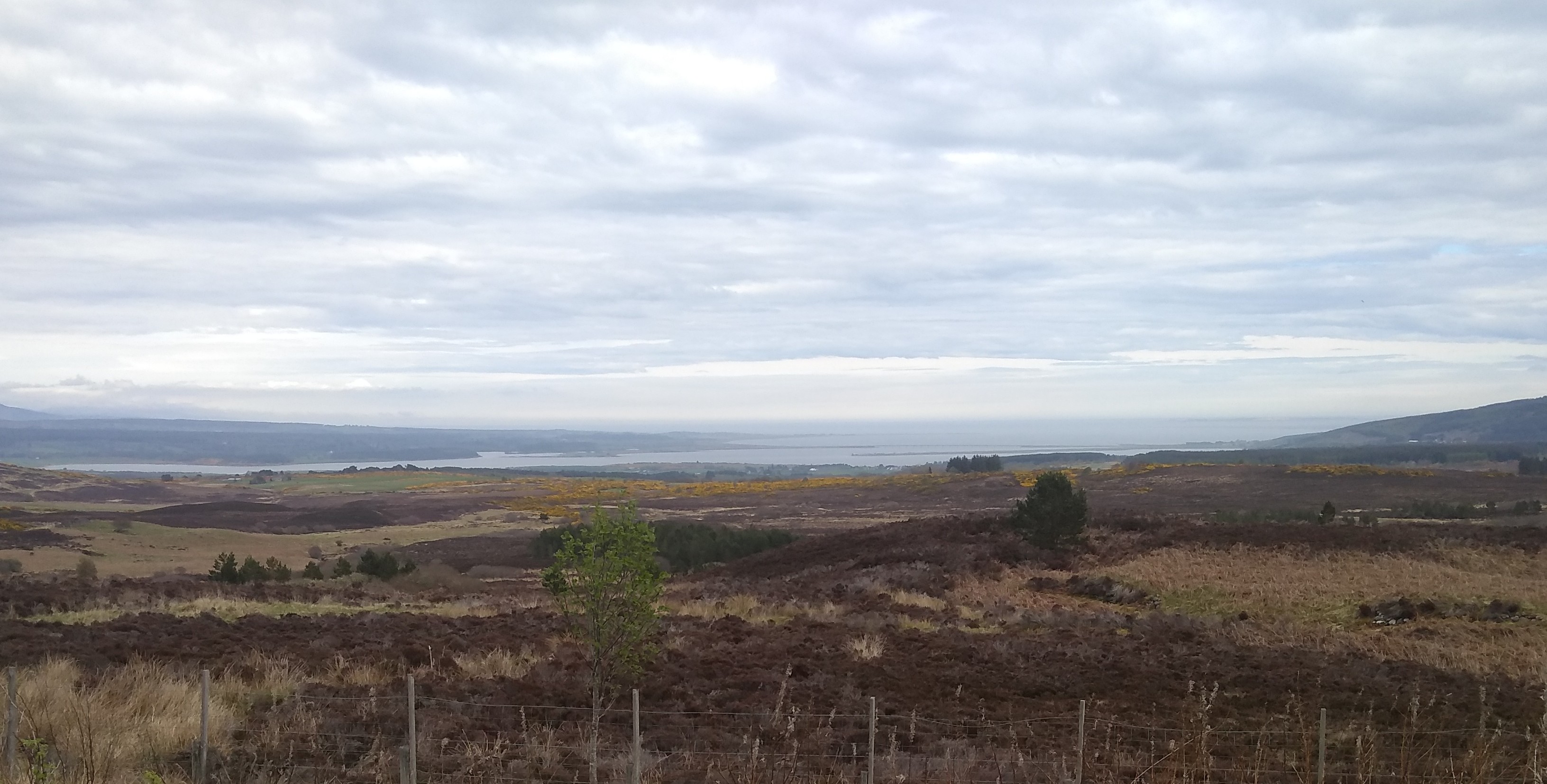
Looking out to the Dornoch Firth
From there it was down to the Kyle of Sutherland and upstream for a while. At some point there was an extremely narrow bike path beside a railway that ended up crossing the river via a cool addition to the railway bridge.
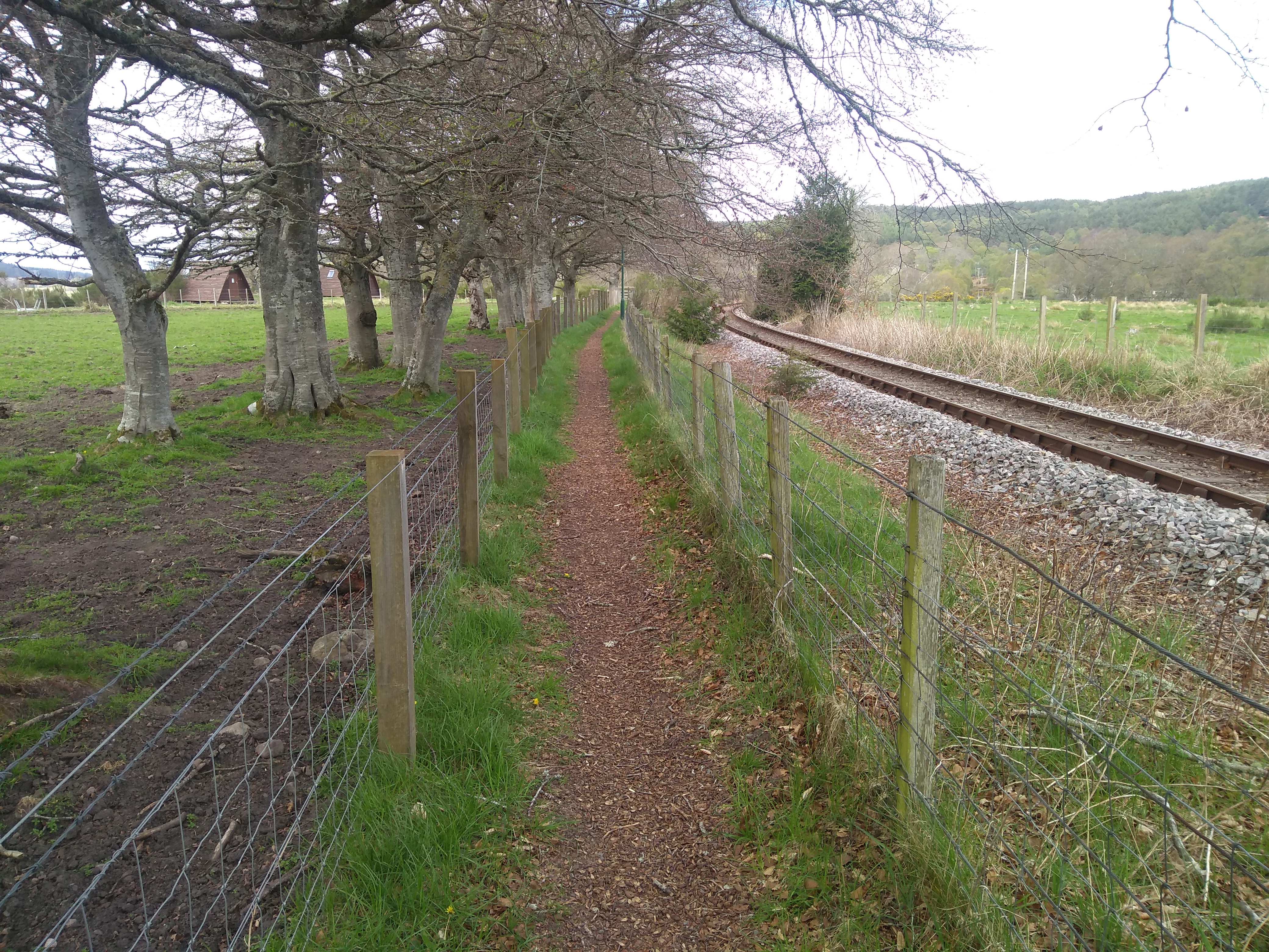
Narrow bike path covered in beech nut shells
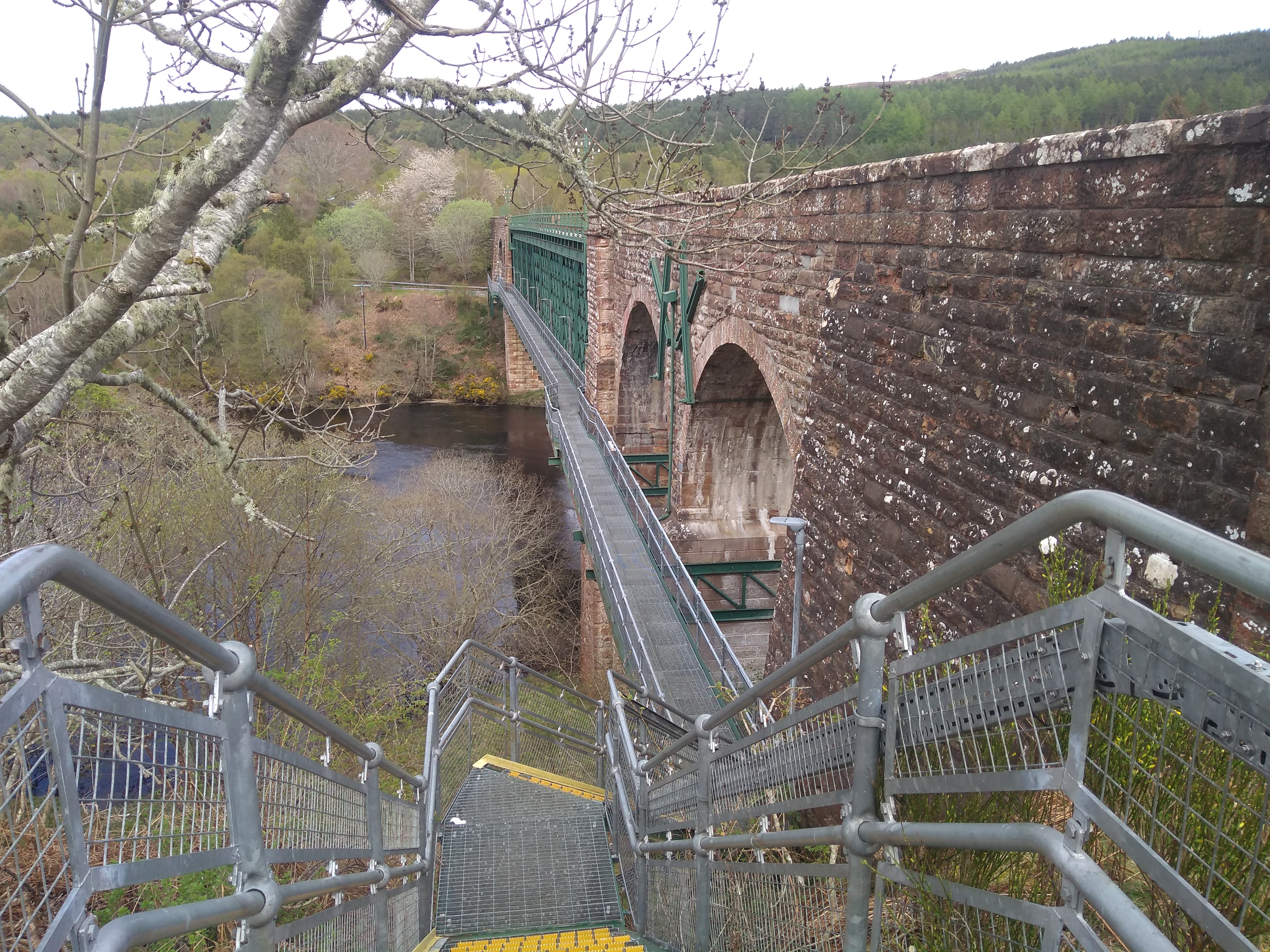
Railway bridge with bike addition
Shortly after that the route turned to follow the River Shin upstream, via the Falls of Shin, and on to Lairg. It was wonderful to be out riding in lovely weather and beautiful scenery!
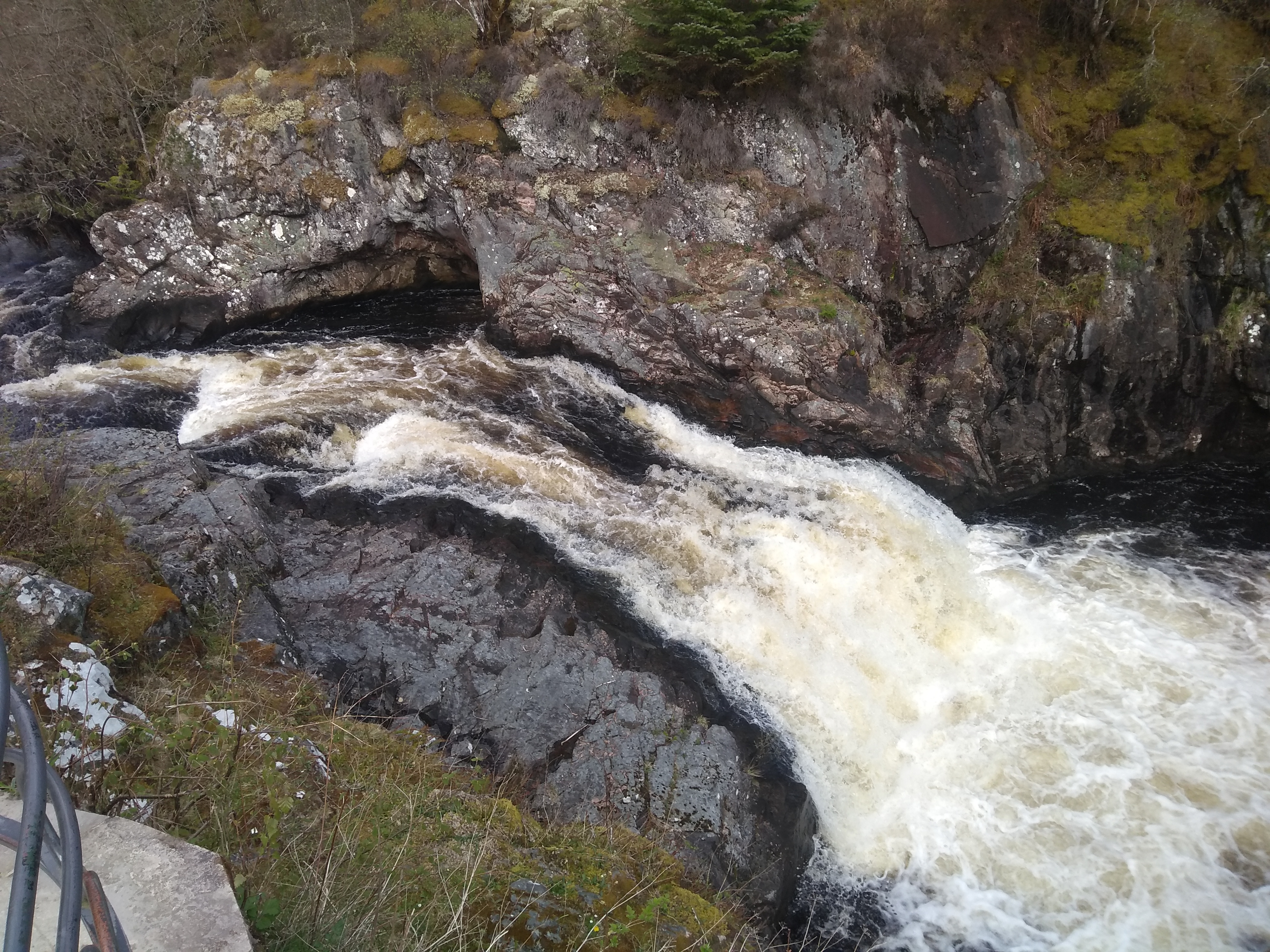
The Falls of Shin, I almost expected kayakers to appear and start “hucking” the falls
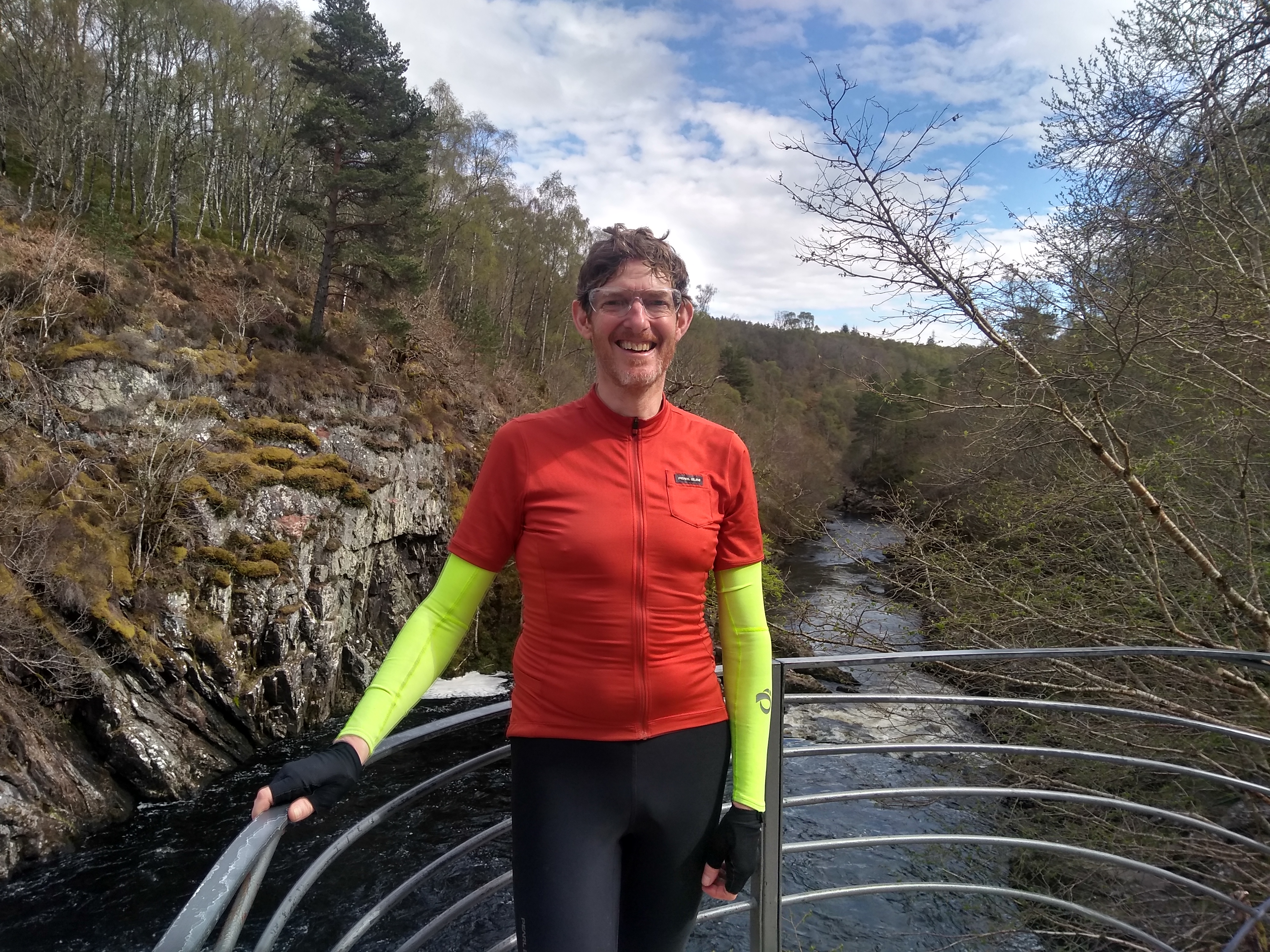
Me by the Falls of Shin
From Lairg it was about 12 miles of increasingly open county to The Crask Inn, my destination. No houses between Lairg and the Inn, except the adjacent one where the couple that used to run the inn live.
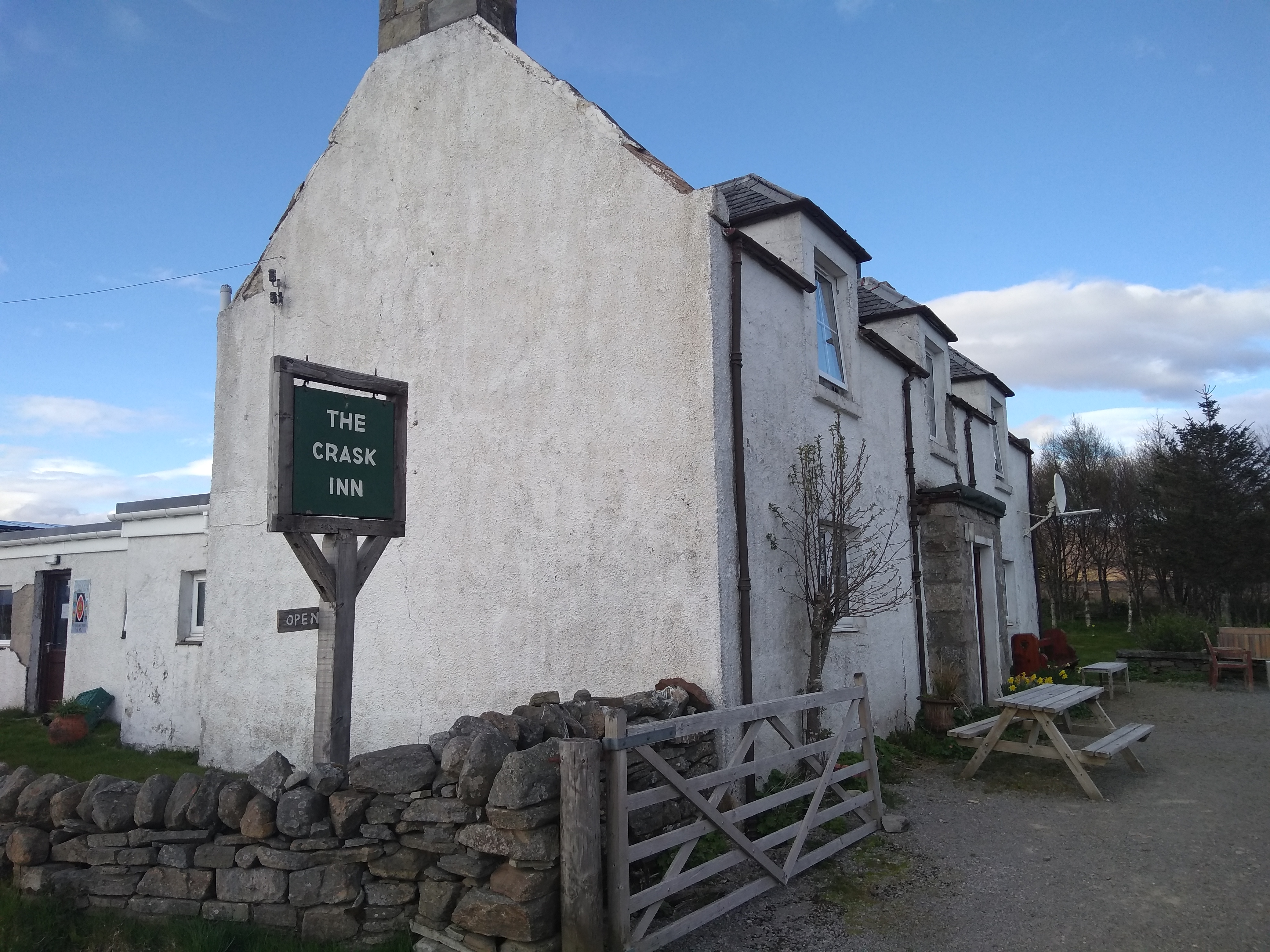
The Crask Inn
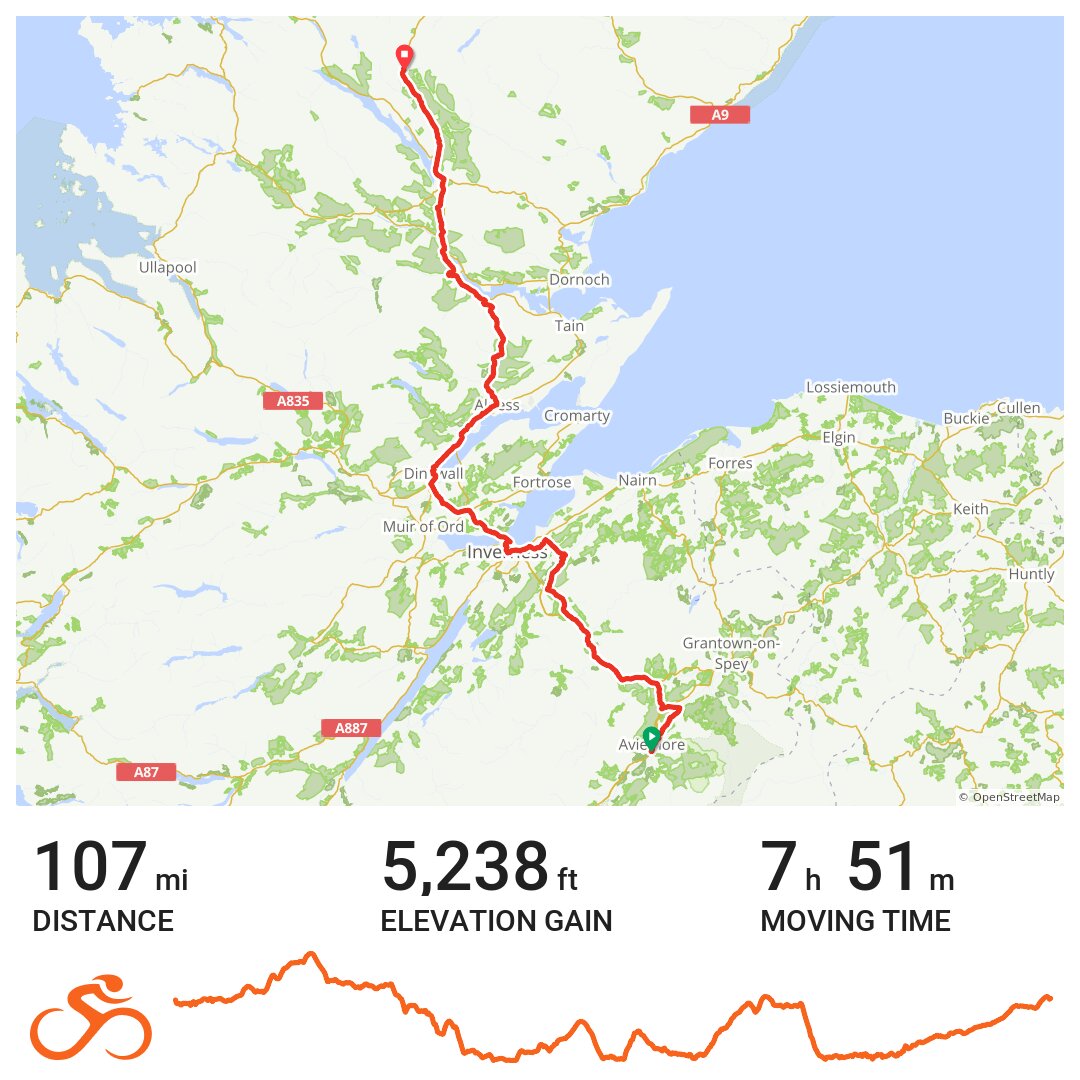
Today’s stats were: 107 miles, 5,200 feet of elevation (in the middle of the range) in just under 8 hours on the saddle. Not only was it a beautiful day but I also felt physically good right to the end — in fact the last 10-15 miles were exhilarating fast riding across the open moorland.